

Deep beneath Lake Huron lies a prehistoric hunting site older than the pyramids, changing what we know about life in North America.
The Alpena-Amberley Ridge crosses the bottom of Lake Huron between northeastern Michigan and southern Ontario. About 9,000 years ago, this submerged limestone formation was dry ground where Indigenous hunters built stone lanes and blinds to intercept migrating animals.
Archaeologists have documented more than 60 stone structures on the Alpena-Amberley Ridge. Their findings include the Drop 45 Drive Lane, chipped stone debris, and two obsidian flakes traced more than 2,400 miles to central Oregon.
Table of Contents
A Ridge Beneath the Waves

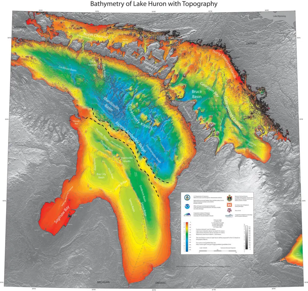
In 2007, scientists exploring the bottom of Lake Huron found something unexpected off the coast of Alpena. Sonar images revealed rock formations aligned too perfectly to be natural. The discovery pointed to something astonishing: a 9,000-year-old hunting ground built when that part of the lake was dry land.
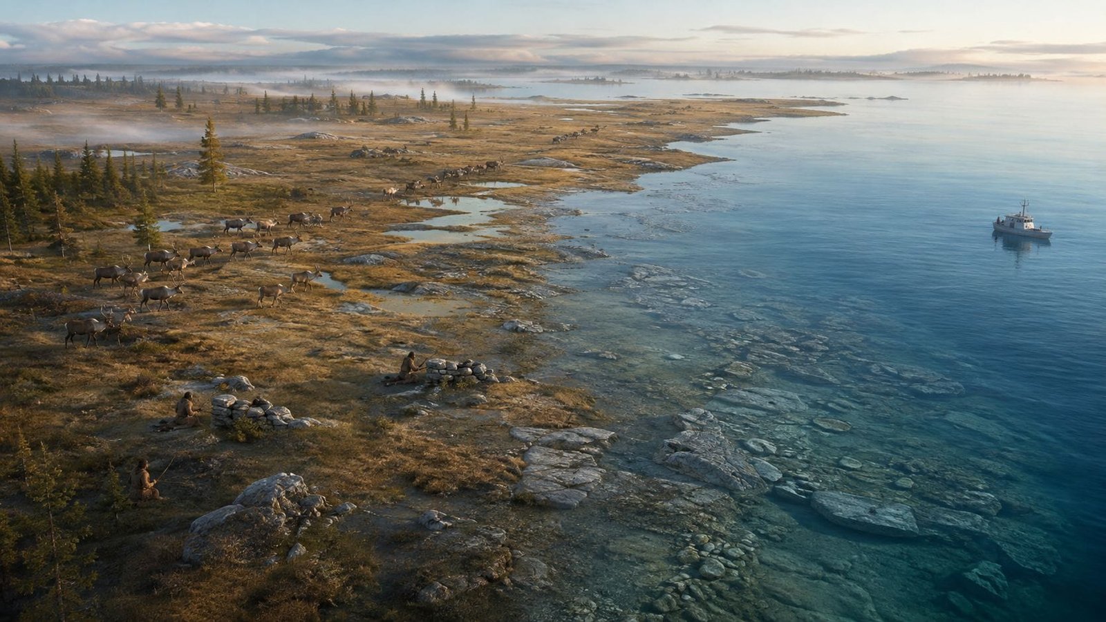
The underwater structures were found along what’s called the Alpena-Amberley Ridge—a submerged land bridge that once connected northeastern Michigan to Ontario. During the last Ice Age, this ridge was dry and teeming with life. Herds of caribou migrated across it, and ancient hunters followed.
Those early people left behind more than footprints. They built stone structures—carefully arranged rock lines designed to funnel caribou into kill zones. These formations represent the oldest known large-scale hunting system in North America.
Ice Age Innovation in Michigan

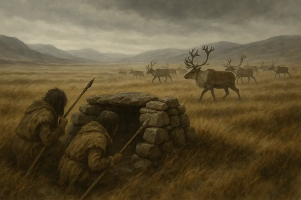
Roughly 9,000 years ago, Lake Huron had not yet filled to its present depth. The Alpena-Amberley Ridge acted as a corridor for migrating wildlife. Small bands of hunters—likely the ancestors of modern Indigenous nations—returned here seasonally to intercept caribou during their crossings.
The structures they left behind show a sophisticated understanding of the landscape. Rock walls were used to direct animals. Ambush points were strategically placed. Archaeologists believe these were part of a broader seasonal hunting strategy that supported communities for generations.
University of Michigan anthropologist Dr. John O’Shea led the research team that discovered the site. His findings changed how scholars view early human activity in the Great Lakes region. “It’s one of the best-preserved hunting landscapes ever found,” O’Shea said in multiple published reports.
What the Lake Huron Ancient Hunting Site Really Is

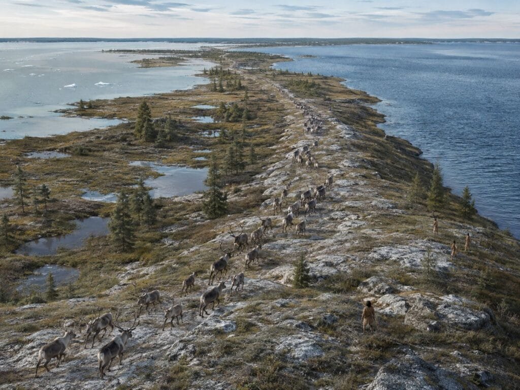
The site lies on the Alpena-Amberley Ridge, a limestone formation running across central Lake Huron between northeastern Michigan and southern Ontario. The ridge averages about 10 miles wide and extends for more than 60 miles, although estimates vary according to how researchers define its endpoints.
During the Lake Stanley low-water period, roughly 10,000 to 8,000 years ago, Lake Huron stood far below its modern level. The exposed ridge formed a broad causeway containing marshes, shallow ponds, streams, grasses, spruce and tamarack trees.
This was not a barren strip of rock. Environmental samples indicate that it supported plants and animals suited to a cool, subarctic climate. Its narrow shape also made animal movement more predictable, giving hunters a major advantage.
Researchers believe caribou migrated across the ridge during spring and fall. Ancient hunters placed stone structures along likely migration routes, using the shape of the ground to guide animals toward waiting hunting parties.
How Researchers Found the Structures
High-resolution maps produced by NOAA during the early 2000s showed the Alpena-Amberley Ridge in new detail. University of Michigan archaeologist John O’Shea recognized that the ridge would have stood above water during ancient low-water periods.
O’Shea collected side-scan sonar images from the ridge in 2008. The images showed long stone alignments and other features resembling caribou hunting structures documented in Arctic regions. A 2009 paper presented the first major scientific evidence for human activity on the ridge. PNAS study on early hunters beneath Lake Huron
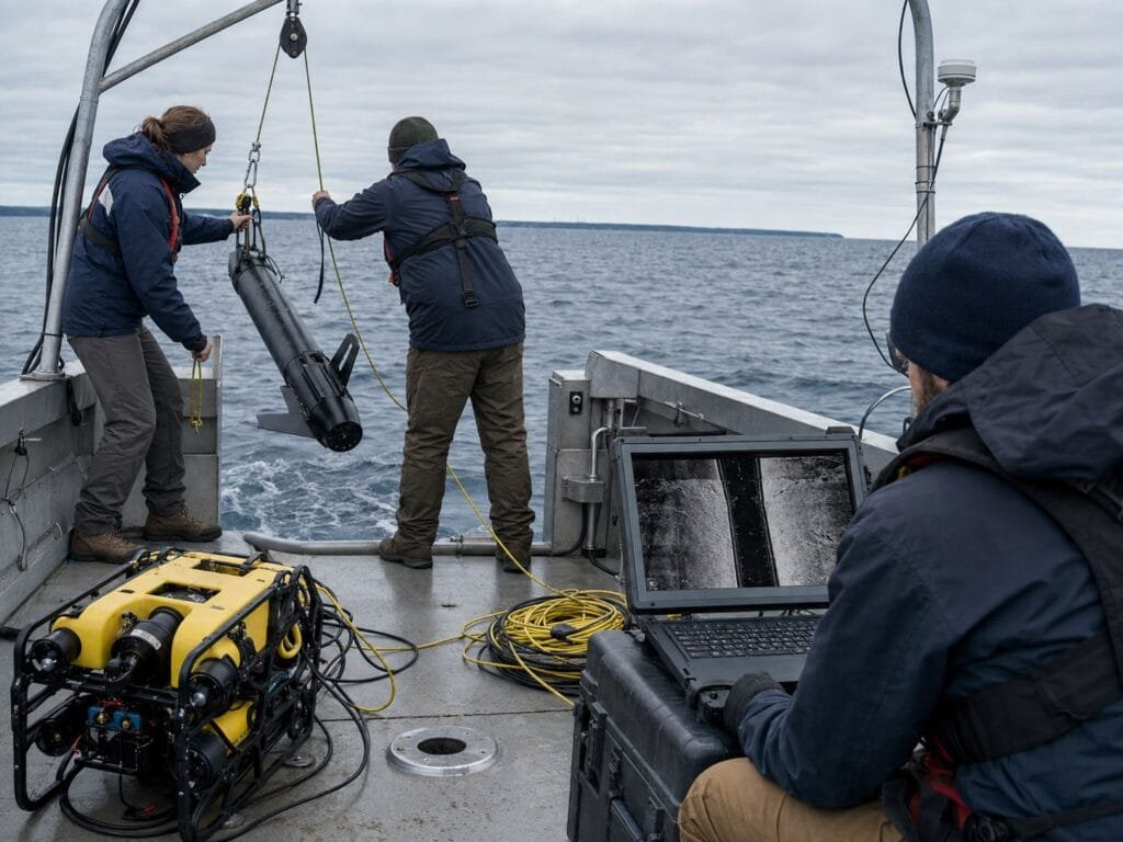
Later work combined side-scan sonar, multibeam mapping, remotely operated vehicles, and scuba-trained archaeologists. Sonar first identified unusual formations. Cameras and divers then allowed researchers to determine whether the stones appeared naturally deposited or deliberately placed.
This layered method matters because the lake bottom contains extensive natural rock deposits. Researchers cannot classify every line of stones as an archaeological structure merely because it looks unusual on a sonar image.
Drop 45: The Best-Known Lake Huron Hunting Structure
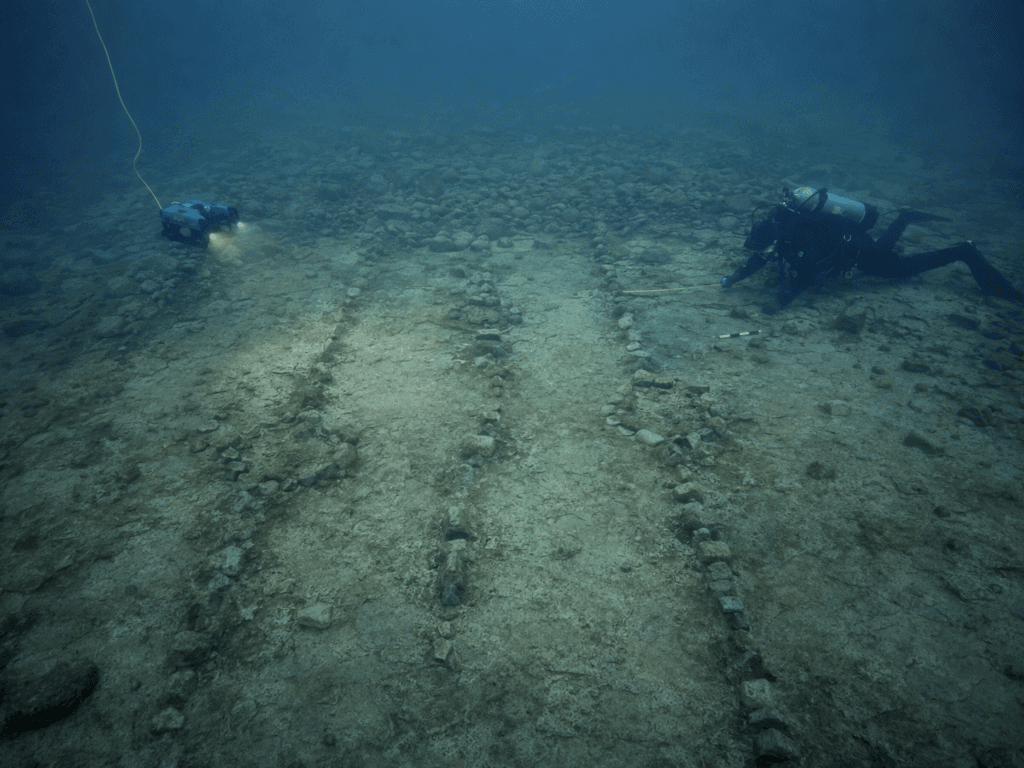
The strongest evidence comes from a site called the Drop 45 Drive Lane. It sits in 121 feet of water about 35 miles southeast of Alpena.
Drop 45 consists of two parallel lines of stones running toward a natural dead end. The main lane measures about 98 feet long and 26 feet wide. Three circular hunting blinds are built into the lane, while additional stone lines appear to have helped direct animals.
The full ambush area measures about 328 feet long and 92 feet wide. Researchers also documented at least four V-shaped blinds and a rectangular formation that may have served as a meat cache within the surrounding 20-acre area.
Scuba archaeologists collected 11 chipped stone flakes from the drive lane and two associated blinds. Their shapes and fracture patterns showed that people produced them while sharpening or repairing stone tools. Most were made from chert available in the region.
Their location is significant. Seven flakes came from the opening of the lane, while four came from two hunting blinds. Other test areas did not produce similar material, reducing the likelihood that random water movement scattered the flakes there. 2014 Drop 45 research paper
The Stones Did Not Need to Form a Fence
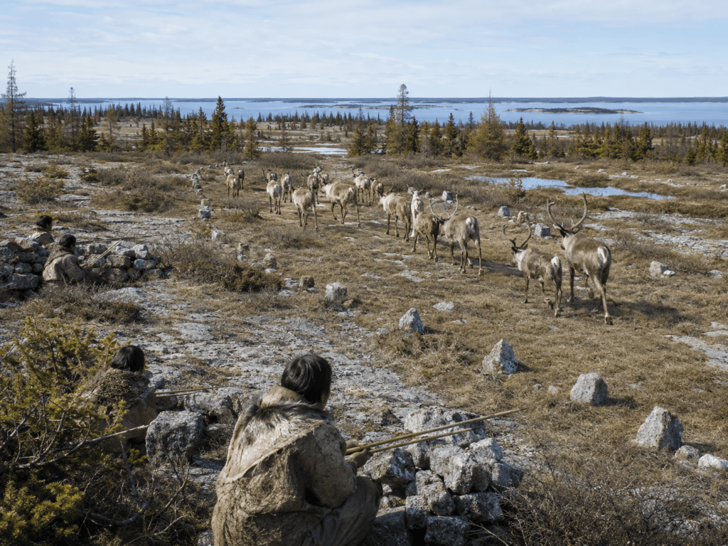
The stone lines were probably not walls in the modern sense. Many were low enough for an animal to step across.
Caribou tend to follow visible lines and natural contours while moving in groups. Hunters could use scattered stones, cairns, and brush to influence the herd’s direction without building a high barrier. The goal was to guide the animals toward hunters waiting in blinds.
Computer models indicated that spring and fall herds may have used different routes. Drop 45 is positioned for animals moving northwest during spring. Researchers argue that its size would have required several cooperating hunters and their families.
Smaller V-shaped blinds face the opposite direction and may have intercepted southeast-moving herds during fall. Those structures could have been used by smaller family groups.
Two Tiny Artifacts Traced to Oregon
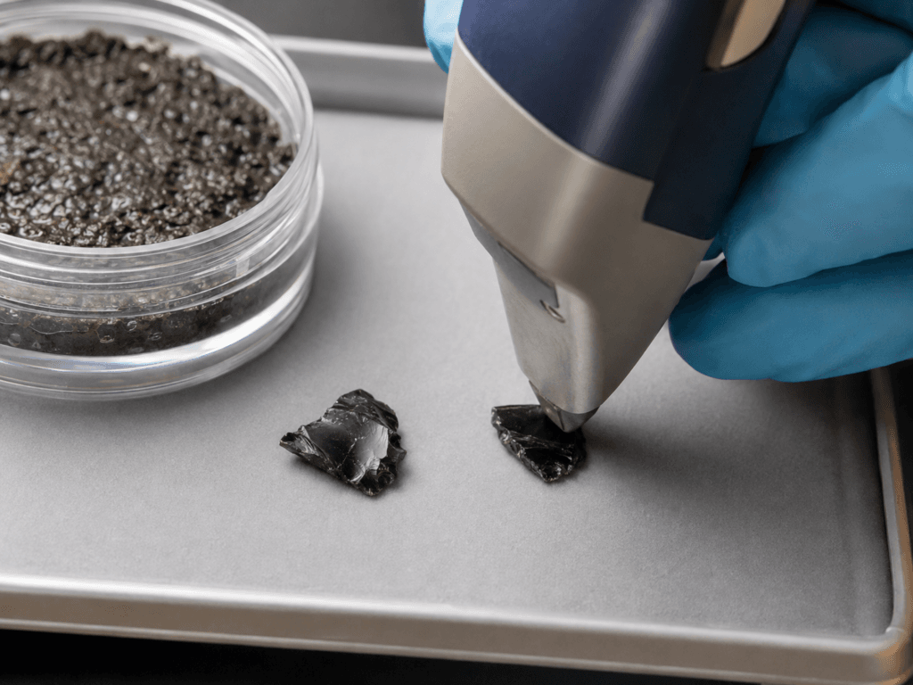
The most surprising evidence did not come from a large structure. It came from two small flakes of obsidian recovered about 105 feet underwater between two hunting features.
Chemical testing traced both flakes to the Wagontire obsidian source in central Oregon, more than 2,400 miles away. They date to approximately 9,000 to 8,800 years ago and are the earliest confirmed western obsidian artifacts found this far east in the continental United States.
The flakes appear to have broken away while someone sharpened or repaired a single obsidian tool. Researchers cannot say whether one person carried that tool from Oregon to Lake Huron. A more likely possibility is that it passed between groups through a long chain of travel, exchange or personal contact.
The finding shows that ancient Great Lakes communities were not isolated. Their material connections may have covered distances that are difficult to imagine today. 2021 PLOS One obsidian study
Underwater Archaeology and Preservation
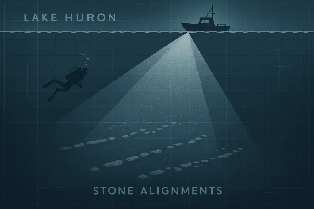
Exploring a submerged site is no easy task. The structures sit beneath more than 100 feet of cold water. Researchers used advanced sonar, remote-operated vehicles, and deep-sea diving to document the ridge—without disturbing it.
Unlike many land-based archaeological sites, this one has remained untouched for millennia. The cold, low-oxygen environment at the lake’s bottom helps preserve organic material like bone, charcoal, and wooden tools. That makes it one of the only places in the world where Ice Age hunting strategies can be studied in their original form.
The Alpena-Amberley Ridge is more than a fossilized footprint. It’s a window into how early humans adapted to environmental change—and a reminder that the Great Lakes basin has been home to human ingenuity far longer than most people realize.
Why the Lake Bottom Preserved the Site
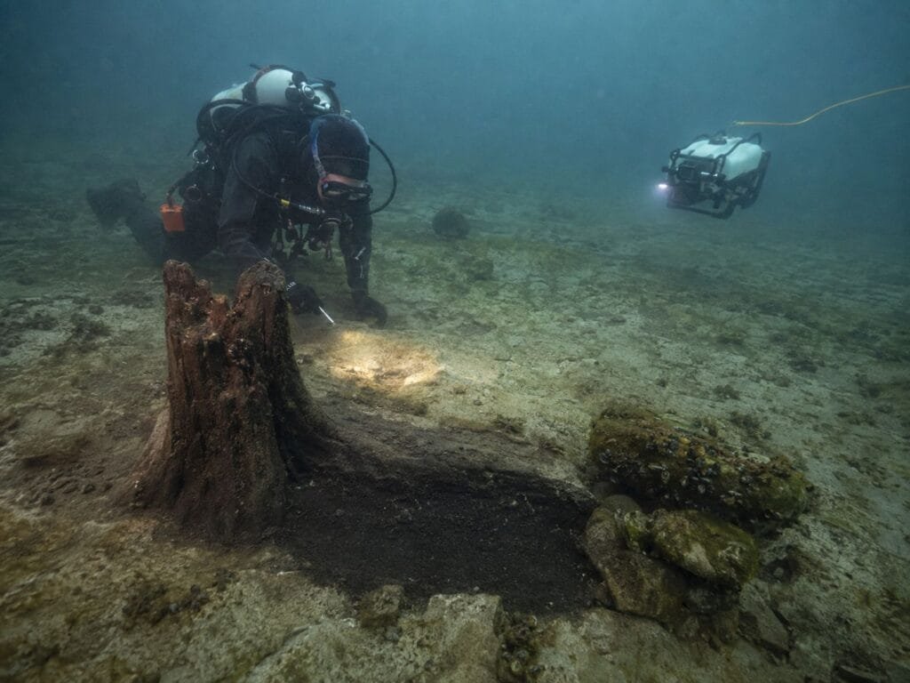
On dry ground, stone features can be scattered by farming, construction, frost, tree growth, and later settlement. The Alpena-Amberley Ridge was flooded as Lake Huron rose and was never exposed again.
Submersion protected many features from later human disturbance. Researchers have also recovered peat, charcoal, pollen, preserved wood, and rooted trees that help reconstruct local conditions at the time of occupation.
Water has not protected everything. Mussels and algae cover many hard surfaces, making small artifacts difficult to see. Cold water and limited dive times also make detailed investigation slow and expensive.
Was It Certainly a Caribou Hunting Ground?
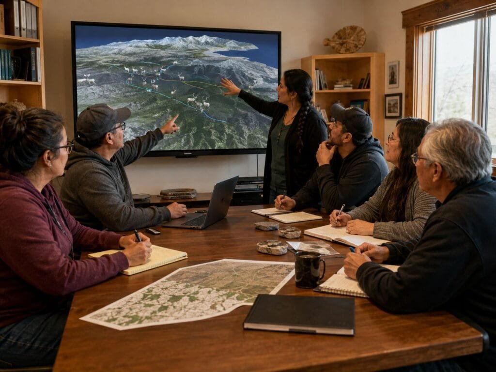
Most researchers working on the Alpenaamberley ridge identify the structures as caribou hunting features. Their case rests on the stone architecture, seasonal orientation, local environmental evidence, computer models, and comparisons with caribou drive systems used in northern regions.
The interpretation is not unanimous. Archaeologist Andrew White argued in a 2021 paper that similar structures could have been used to hunt other large animals and that parts of the caribou model require more testing. White’s critique in PaleoAmerica
Archaeologist Ashley Lemke responded that years of fieldwork had produced human-built features, stone artifacts and environmental evidence supporting the hunting interpretation. The fair conclusion is that organized hunting occurred on the ridge. Caribou remains the leading explanation, but the exact prey, number of hunters, and frequency of use remain subjects of research.
Connecting to Indigenous History
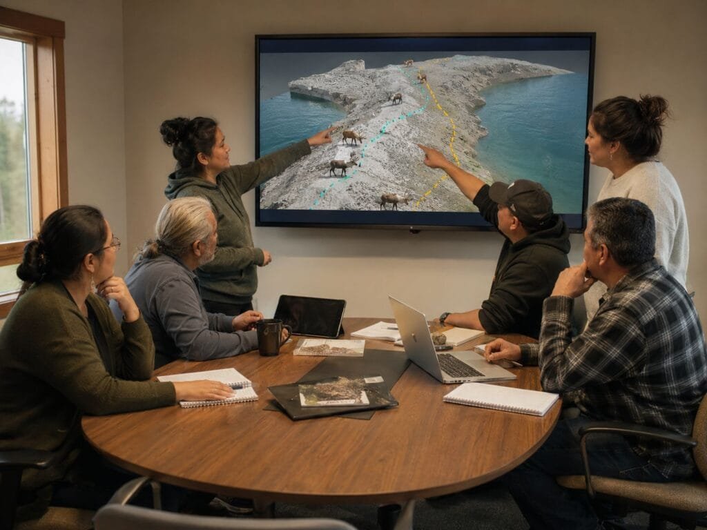
The builders were Indigenous people living in the Great Lakes region about 9,000 years ago. Archaeology cannot identify them as members of any present-day tribal nation with certainty.
Researchers have worked with traditional knowledge keepers from the Native Village of Kotzebue in Alaska, where community members retain direct cultural knowledge of caribou hunting. They reviewed virtual models and advised researchers on caribou movement and hunting decisions.
That consultation does not mean the ancient Lake Huron hunters were Iñupiat. It allowed people with lived caribou-hunting knowledge to test assumptions that computer scientists and archaeologists might otherwise miss. A 2025 scholarly review describes this work as a move toward fuller Indigenous participation in underwater archaeology.
Frequently Asked Questions
Was a lost city found under Lake Huron?
No. Archaeologists found hunting structures, stone artifacts, ancient plant material and evidence of human activity. No city, streets or permanent buildings have been identified.
How old is the Lake Huron ancient hunting site?
The best-known structures and artifacts are about 9,000 years old. Related environmental dates and lake-level records place human activity during the Lake Stanley low-water period.
How deep is the site?
Different features lie at different depths. Drop 45 is about 121 feet underwater, while the Oregon obsidian flakes were recovered at roughly 105 feet.
What is the Drop 45 Drive Lane?
Drop 45 is a stone hunting complex containing parallel drive lines, circular blinds and additional guiding structures. Its main lane is about 98 feet long and 26 feet wide.
Where did the Lake Huron obsidian come from?
Chemical analysis traced the two flakes to the Wagontire source in central Oregon. Researchers do not know how many people or exchanges were involved in moving the material to the Great Lakes
Why the Alpena Ridge Still Matters
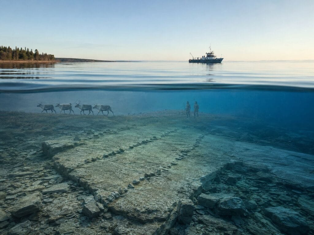
The Lake Huron ancient hunting site changes the scale of Michigan’s early human story. Its builders did not simply follow animals and react to chance encounters. They planned hunting locations, moved stones, maintained structures, and coordinated group labor.
The Oregon obsidian adds another dimension. Even small mobile communities could be connected to wide systems of travel and exchange. Isolation should not be assumed simply because the population was small and the period was ancient.
The site also shows why parts of the Great Lakes archaeological record appear incomplete. Places where people camped, traveled, and hunted may now sit beneath deep water. The missing evidence was not always destroyed; some of it was flooded.