Blissfield, Michigan, built its identity in the same way many small towns did in the late 1800s and early 1900s: through location, transportation, and steady civic life. The River Raisin ran close enough to shape daily routines, and rail lines ran close enough to shape the local economy. Over time, wires and roads joined the rails. Cars replaced the horse era. A traffic light appeared over Lane Street. The photos in this episode show the history of Blissfield, Michigan, from pioneer days to the 20th century in just a few short years.
Blissfield Michigan History
Video – History of Blissfield: Floodwater, Rails, and a Main Street That Kept Moving

Images on this page may contain affiliate links in which we may receive a commission. See our affiliate disclosure for details.
Historic Photos of Detroit in the 50s, 60s, and 70s
Historic Photos of Detroit in the 50s, 60s, and 70s documents what a Metro Detroiter would have experienced through those decades, from the commonplace—to a visit from John F. Kennedy.

A Beautiful Michigan Town Shaped By the Raisin River


The History of Blissfield Michigan is not one headline. It is a chain of ordinary decisions—where to build, how to ship goods, where to worship, and where to gather—that add up to a town with a strong downtown core.
A Downtown that Learned to Watch the Raisin River

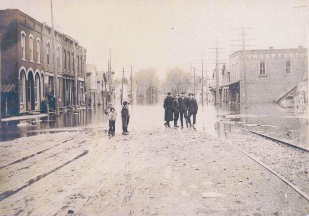
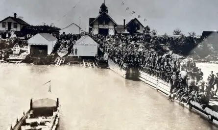
One of the most striking images shows Blissfield’s business street under floodwater. Brick storefronts line both sides, and people stand in the street as if they’ve stepped out to document a temporary, dangerous change. The scene feels calm, but the water says otherwise.

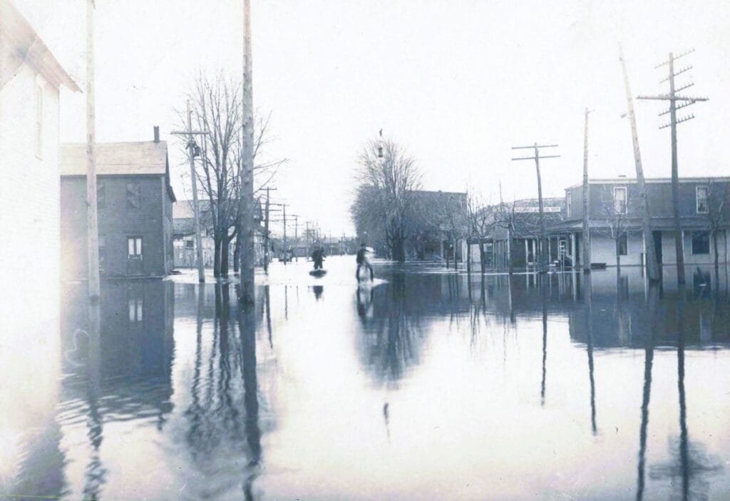
The River Raisin’s geography helps explain why flooding would reach into a town like this. State-level fisheries and river reports describe the Raisin in this region as a river with low banks and a broad floodplain. That makes seasonal high water and extreme flooding more than a rare surprise.
Third Times the Charm – Blissfield’s Triple Bridges

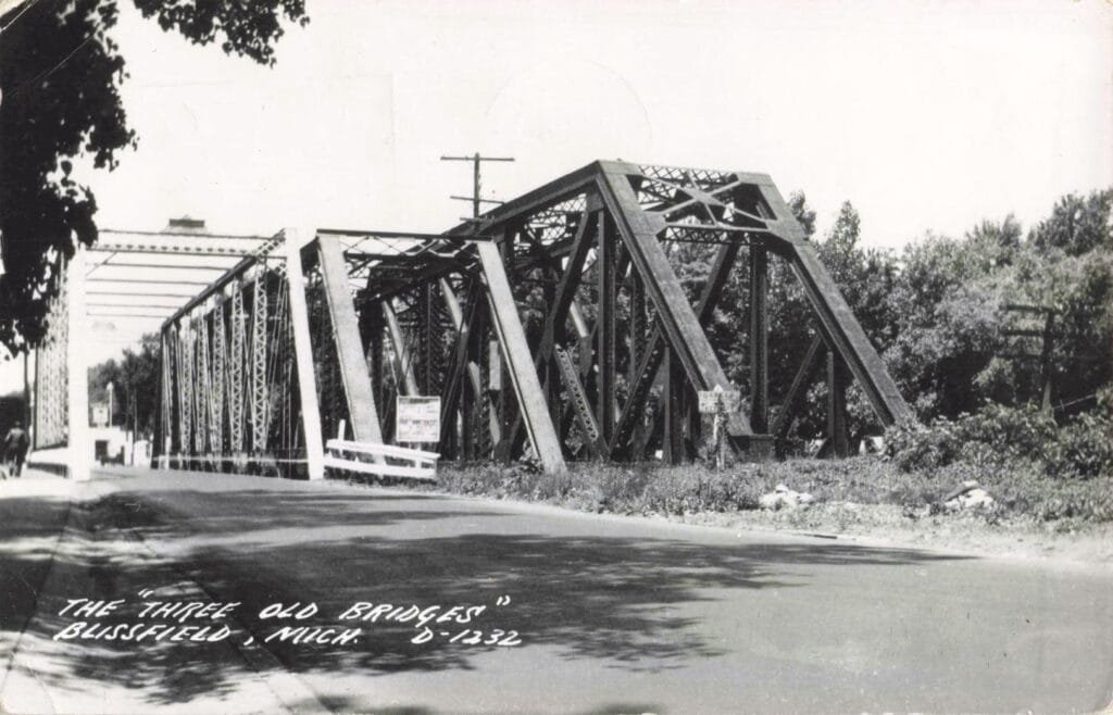
In the history of Blissfield, Michigan, the cluster of crossings known locally as Blissfield’s Triple Bridges formed for practical reasons, not spectacle. As rail service expanded in the late 1800s, iron truss bridges were built to carry heavy freight trains over the River Raisin at a fixed alignment. Those rail spans came first and stayed in place as traffic grew. When wagon traffic increased—and later automobiles—the village added a separate road bridge rather than rebuild the rail crossing. Each structure answered a different need, and each was added beside what already worked.

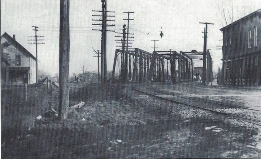
The result was three bridges standing side by side in Blissfield, built in stages over decades. The photos show parallel iron trusses, steam locomotives, and unpaved approaches, all typical of the era. What looks excessive today was a cost-effective choice at the time: keep commerce moving, avoid long shutdowns, and spread upgrades over years. As rail traffic declined and highways modernized in the mid-20th century, the clustered crossings gave way to fewer, wider spans designed for cars.
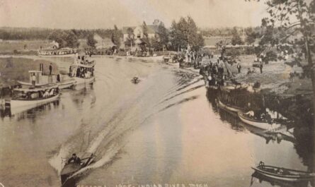
Blissfield’s Rail View from Above
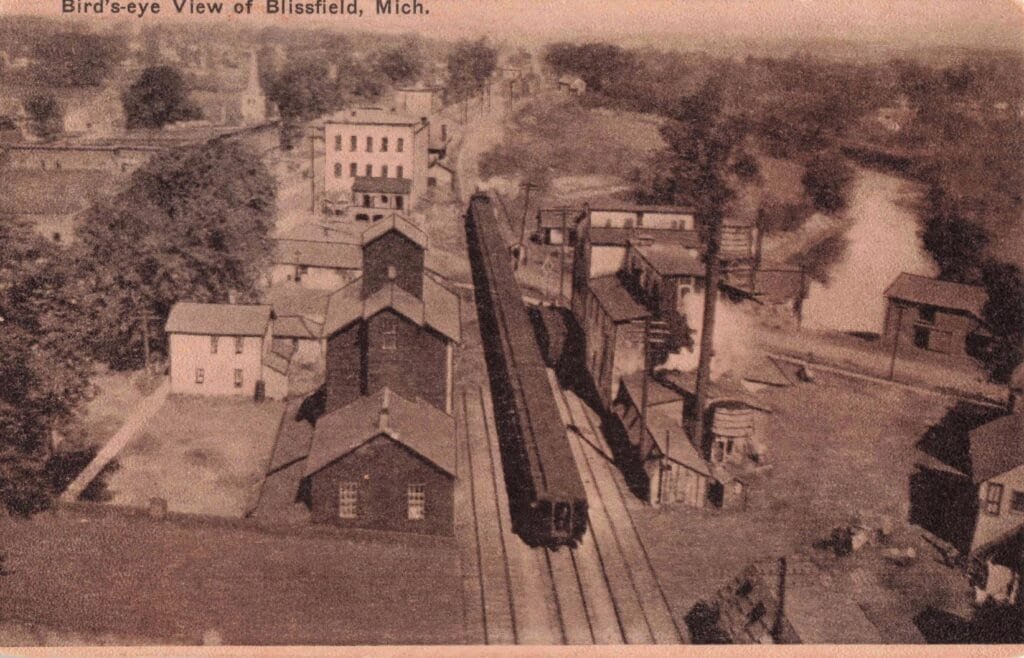
Another postcard pulls the camera up and back: “Bird’s-eye View of Blissfield, Mich.” Rail tracks run through the scene. Nearby stands an industrial site with a smokestack. Even if the card does not name the business, the layout says a lot. This is a town tied into regional shipping routes. Freight could move in and out without needing a port city.
Michigan rail reference sources document Blissfield’s rail setting and even note an electric railway depot in town. Put simply: if you wanted to sell what you produced—farm output, lumber, manufactured goods—rail access mattered.
The Wired Future – Blissfield’s “Electric Depot”

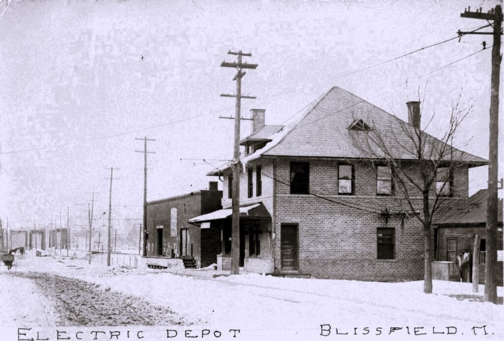
A postcard labeled “ELECTRIC DEPOT BLISSFIELD, M.” shows a sturdy brick building. The label does not explain whether this site served local electric power, an electric railway, or both. What it does show is investment. This is not a temporary shed. It is a building meant to last.

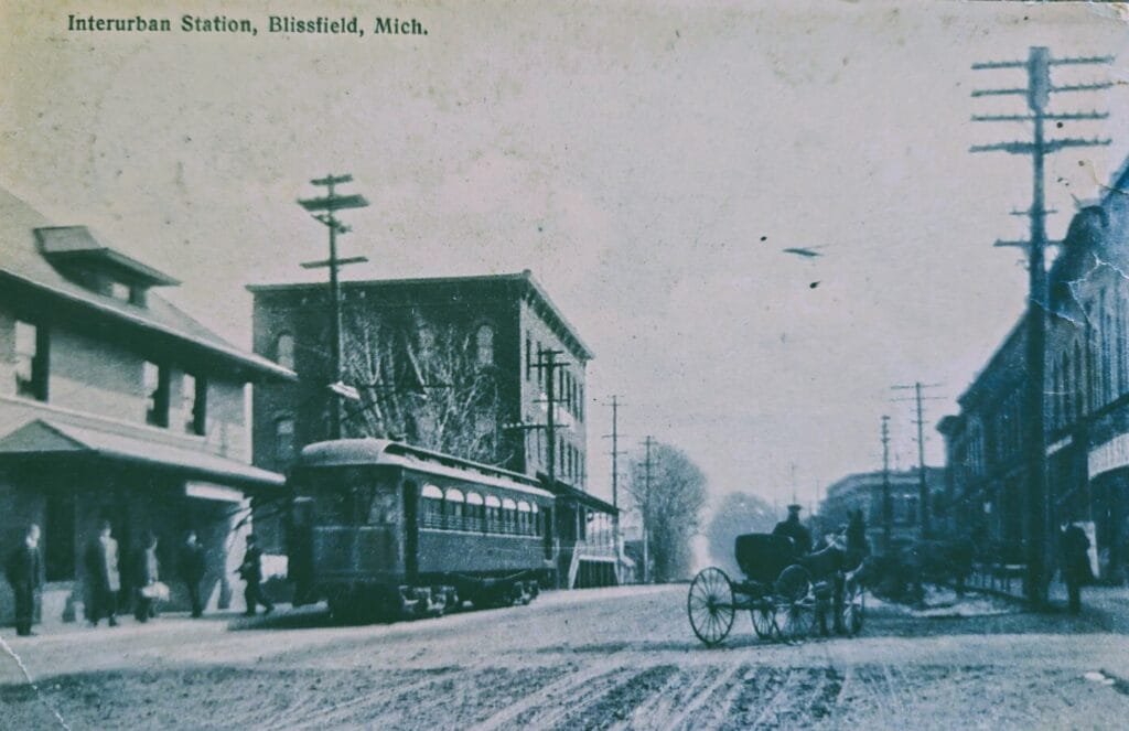
When people talk about the history of Blissfield Michigan’s early transportation, they often focus on big-city streetcars. Small towns also touched that era. Documentation of the Toledo & Western interurban network includes Blissfield in the early 1900s system geography. The postcard fits the period when electric service and electric transit were changing what “distance” meant in daily life.
Blissfield Churches as Civic Anchors

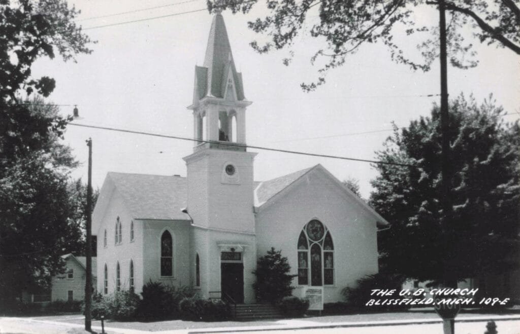
Two postcards in the history of Blissfield Michigan, show church buildings that are clearly meant to be recognized.
One reads “THE U.B. CHURCH BLISSFIELD, MICH.” A museum post notes that the Blissfield United Brethren congregation was established in 1887 and that an early church building followed soon after.

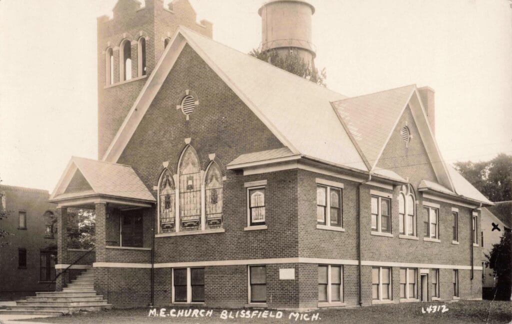
Another reads “M.E. CHURCH BLISSFIELD, MICH.” Methodist Episcopal churches often served as more than worship spaces. In towns like Blissfield, they were common sites for community meetings, charity work, music events, and social life, especially in the early 1900s.
Coon’s Tavern and the Downtown Promise

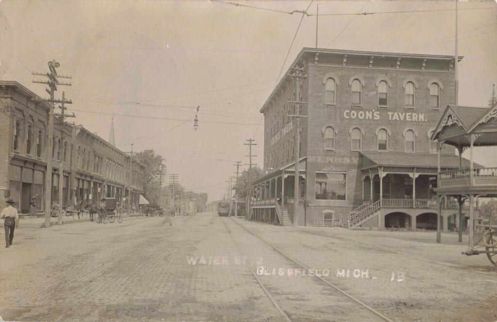
Two photos feature the same large brick landmark: “COON’S TAVERN.” It has porches built for people to sit, watch the street, and meet arriving guests. The building’s size suggests it served a regional role, not just a local one.

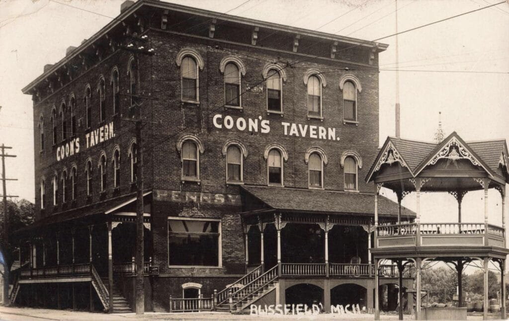
A preservation-focused historic resources report documents Blissfield’s long-running hotel building and its later association with Edwin A. Coon, along with its downtown role over time. This is the kind of structure that tells you how a town wanted to be seen: stable, welcoming, and connected.
East Blissfield and the Rail Corridor

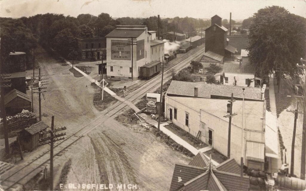
A postcard labeled “E. BLISSFIELD MICH” shows tracks, utility poles, and buildings lined up along the corridor. It reads like the working edge of town—where freight, supplies, and labor met the timetable.
Lane Street Blissfield North – Cars, Awnings, and a Rare Traffic Light
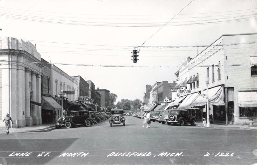
A later street scene labeled “LANE ST. NORTH BLISSFIELD MICH.” shows what a lot of small towns aimed for by the 1930s and 1940s: a full commercial strip with parked cars, store awnings, and a traffic signal suspended over the intersection.
That traffic light is a small detail with a significant meaning. It signals volume. It signals modern rules replacing informal street customs. It also shows how Main Street businesses depended on circulation—people coming in, shopping, and moving on.
Early Autos Posed as a Statement

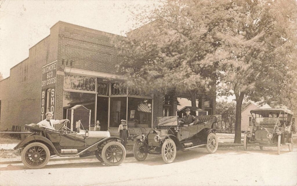
The last photo feels earlier than the traffic-light scene. Three automobiles are parked in front of a brick storefront. The sign on the building reads “DRY GOODS,” with “BOOTS” and “SHOES” also visible. Adults and children pose carefully, as if the vehicles are part of the town’s identity.
That’s the point. In the early auto era, a car was transportation, but it was also status and momentum. The History of Blissfield Michigan, is full of these quiet pivots—rail first, electric service and transit next, then the car taking over.
Federal art in a small-town post office

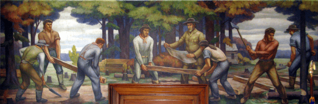
Here’s the detail many viewers don’t expect. Blissfield’s post office received a New Deal-era mural by artist Jean Paul Slusser titled “Laying the Erie and Kalamazoo Railroad.” Records list the mural at the Blissfield post office on South Lane Street, dated to the late 1930s.
That matters because it puts Blissfield into a national story. Federal programs did not only reshape big cities. They also left lasting marks in small towns—often in everyday places like a post office lobby.
Why these photos still matter
Taken together, these images show a Michigan town balancing two forces: connection and exposure. Blissfield gained opportunity through rails, wires, and roads. It also carried the risk that comes with building near a river in low country.
The History of Blissfield Michigan is written in brick storefronts, church steeples, and a downtown tavern built big enough for outsiders. It is also written in floodwater, when the street turns quiet and people step out to record what they can’t control.