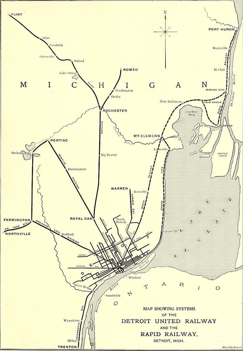
This 1902 map shows how electric rail lines once fanned out from downtown Detroit — not just through the city, but into places like Pontiac, Royal Oak, Rochester, Romeo, Flint, and along the Lake St. Clair shoreline toward Port Huron.
At the time, Detroit United Railway had recently been created by consolidating multiple street railway companies, and it was rapidly building and buying lines that linked Detroit to fast-growing suburbs and nearby cities. The Rapid Railway name is tied to the interurban corridor that ran up Gratiot Avenue toward Mount Clemens and beyond.
If you could hop an interurban from Detroit for a day trip in 1902, where would you have gone — Flint, Port Huron, Pontiac, or somewhere else?
#DetroitHistory #MichiganHistory #Streetcars #Interurban #TransitHistory