 by
by More than a decade before Route 66 became America’s best-known road, motorists were already following the Dixie Highway. Michigan routes set the stage for cross-continental travel in the US.
Watch – Michigan’s Dixie Highway
The Dixie Highway Association
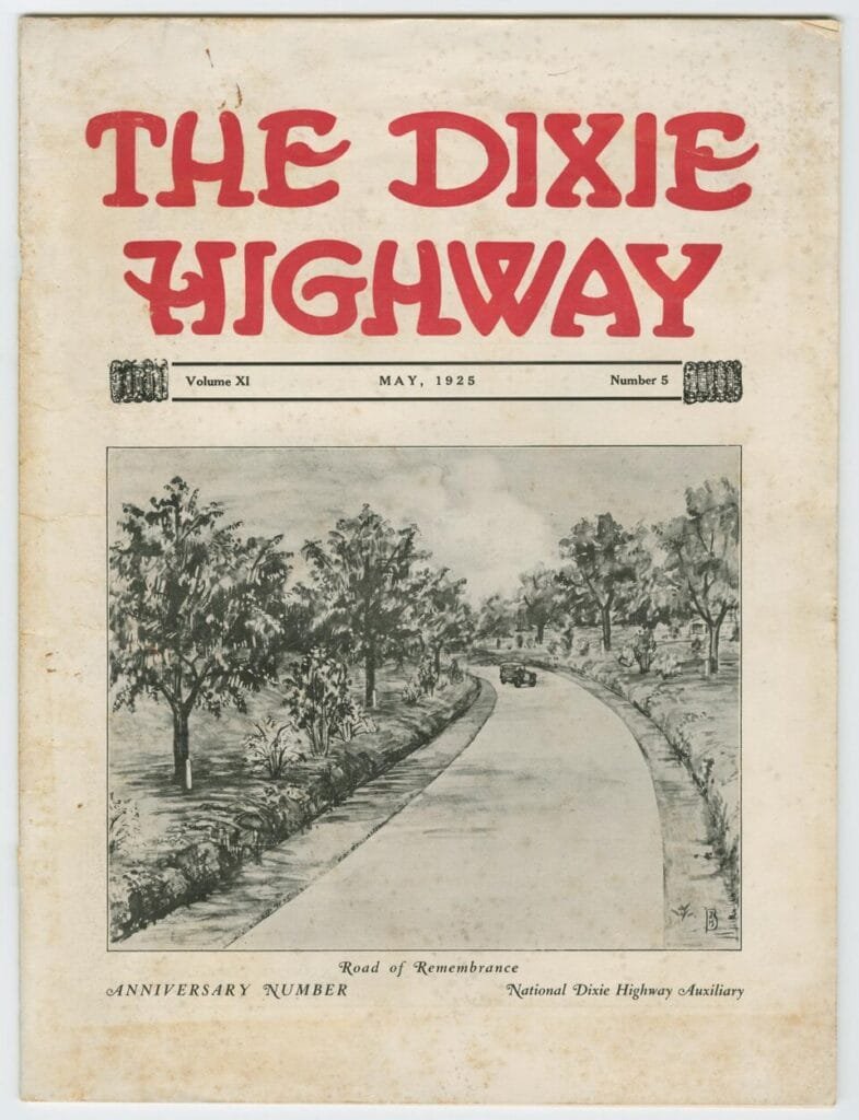
The Dixie Highway Association was organized in 1915, while Route 66 did not receive its federal number until 1926. That gave the Dixie Highway an 11-year head start. Its sprawling network linked Mackinaw City, Detroit, and Chicago with cities across the South before reaching Miami. In Michigan, its eastern and western divisions formed a massive loop through the Lower Peninsula.
But the Dixie Highway was not the nation’s first transcontinental highway. In road history, “transcontinental” usually means an east-to-west route connecting the Atlantic and Pacific coasts. The Dixie Highway ran mainly north and south, linking the Great Lakes region with Florida.
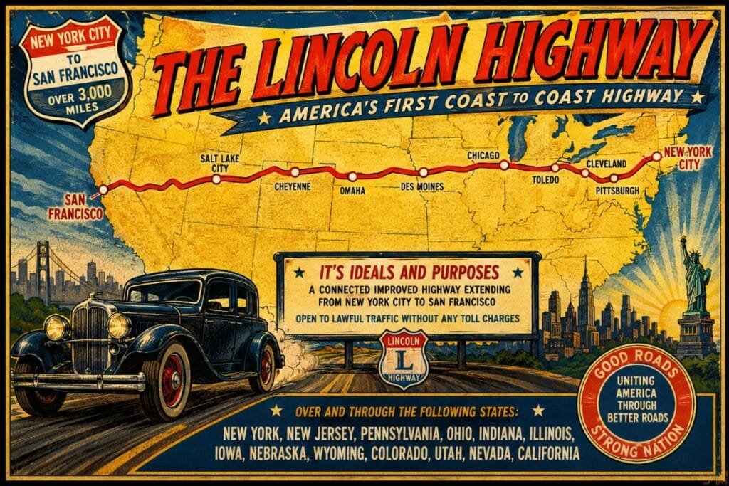
That distinction belongs more closely to the Lincoln Highway, whose New York-to-San Francisco route was announced in 1913. Even that claim warrants caution, as earlier groups had proposed or promoted ocean-to-ocean roads. Still, federal highway historians generally recognize the Lincoln Highway as the most influential early transcontinental automobile route.
The Dixie Highway was important for a different reason. It was one of America’s first major north-south automobile systems and one of the earliest attempts to connect northern industrial cities with southern tourist destinations. It predated the numbered U.S. highway network and helped prove that long-distance automobile travel could support hotels, garages, restaurants, resorts, and entire roadside business districts.
Long before travelers went looking for kicks on Route 66, Michigan drivers were already pointing their cars south toward Miami.
Carl Fisher Proposes a Road South
The Dixie Highway was promoted by Carl G. Fisher, an Indiana businessman who also played a major role in the Lincoln Highway. Fisher understood that automobile sales depended on usable roads. He also knew that long-distance highways could create new markets for hotels, garages, restaurants, and tourist attractions.
The Dixie Highway Association was organized in late 1914. The original proposal called for a highway linking Chicago and Miami. Governors and highway officials met in Chattanooga, Tennessee, in April 1915 to discuss the route. Each participating state selected representatives to help decide where the road would run.
The proposal soon grew beyond a single line. Communities wanted access to the highway because they understood what it could bring. A place on the route could mean more visitors, more investment, and more business. Michigan wanted a major role.
Michigan Pushes Its Way In on the Map
Michigan was not central to the earliest Chicago-to-Miami plan. State leaders and local boosters quickly argued that the highway should include Detroit and continue north through the Lower Peninsula.
By May 1915, Michigan had agreed to support a large loop.
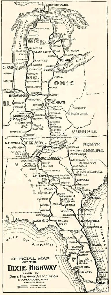
The proposed Michigan route entered from northern Indiana and traveled through Niles, Kalamazoo, and Grand Rapids. It then continued north through western Michigan’s resort region to Mackinaw City.
From there, the route turned south along the eastern side of the state, passing through communities tied to the growing state highway network before reaching Detroit and Toledo.
The result gave the Dixie Highway two main northern divisions. The Western Division served Chicago and western Michigan. The eastern division connected Detroit with Ohio and the states farther south.
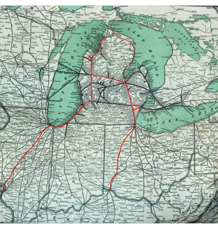
Period maps showed the highway reaching from Mackinaw City to Miami. Later versions extended the eastern division north toward Sault Ste. Marie. Michigan had turned a southern road proposal into a route that crossed much of the state.
A Highway Built From Existing Roads
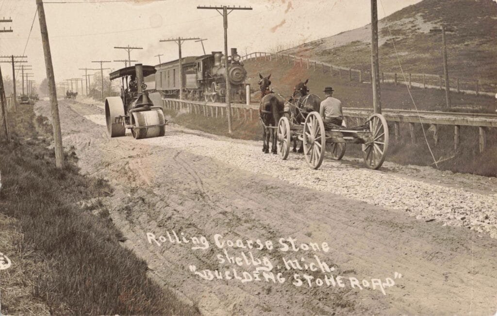
The Dixie Highway was not constructed as one new road under a single government program. It was a collection of existing roads chosen, promoted, and gradually improved under a shared name.
Road conditions could change suddenly from one county to the next. One section might have a firm gravel base. Another could be a little more than a dirt lane. A paved stretch could end without warning. County road commissions, local governments, and state officials were responsible for the actual work. They raised money through taxes, appropriations, and bond issues.
The Dixie Highway Association promoted the route, published maps, and encouraged communities to improve their sections. The association’s plans were national. The construction work was local.
What the Road Looked Like in Waterford
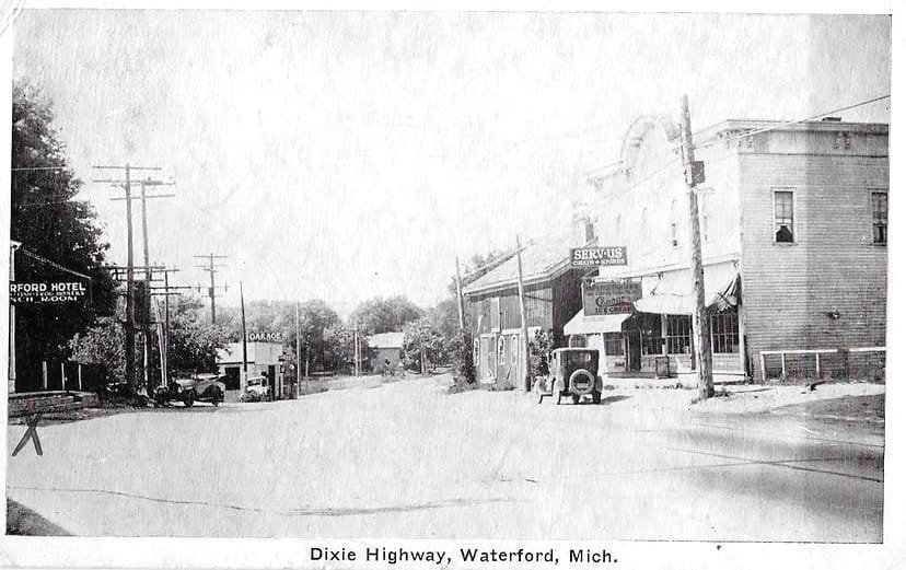
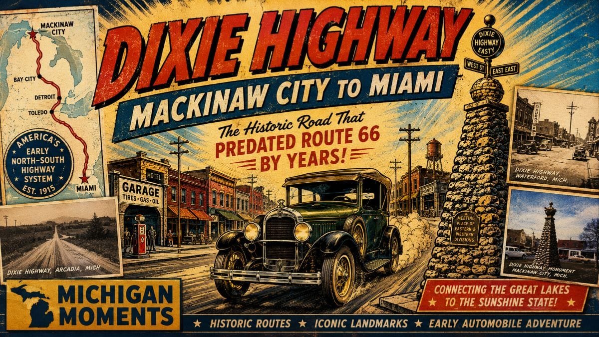
An early postcard labeled “Dixie Highway, Waterford, Mich.” shows how the road shaped a small Michigan business district. Telephone poles line the street. A hotel sign appears on the left. A garage stands farther down the road. Storefronts advertise ice cream and other goods. An automobile is parked near the curb.
The scene is quiet, but the business pattern is clear. Travelers needed fuel, food, and repairs. They also needed lodging when poor roads, bad weather or mechanical trouble slowed their trip.
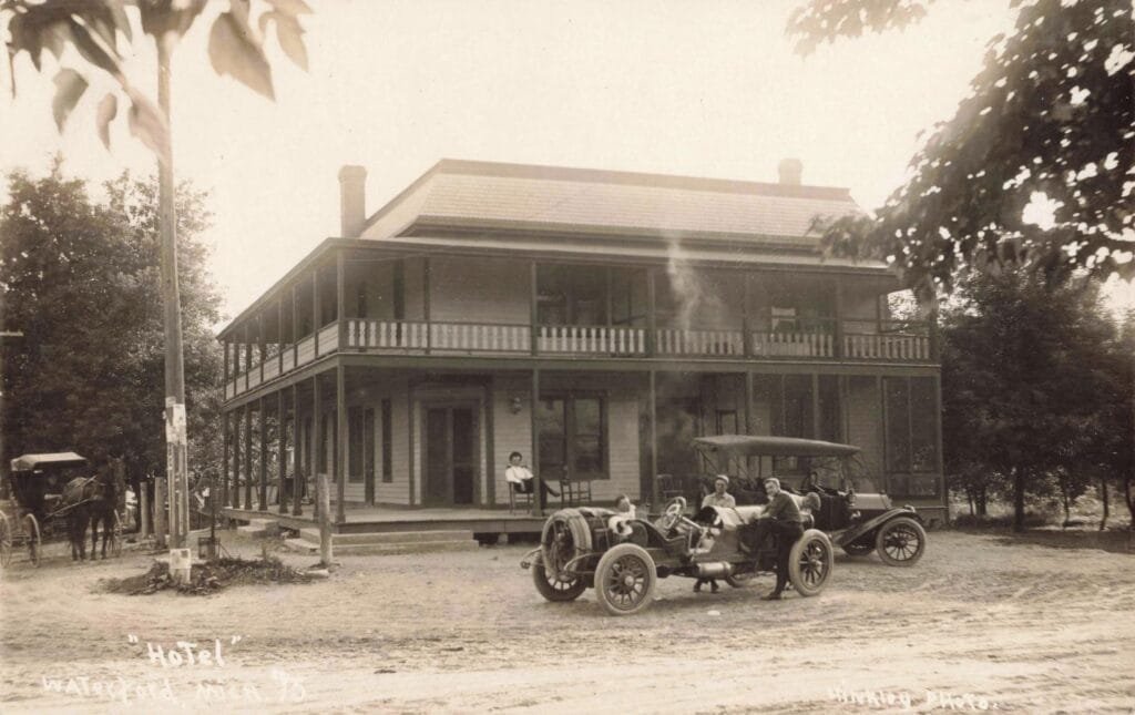
Garages became essential roadside businesses. Hotels began advertising directly to motorists. Restaurants and stores placed signs where drivers could see them from the road. The highway did not merely pass through these towns. It changed how they operated.
The Western Route and Michigan Tourism
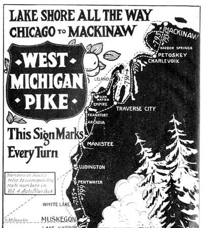
The western side of the Michigan loop followed routes associated with the West Michigan Pike.
The pike was promoted with the slogan “Lake Shore All the Way.” It directed motorists through communities along Lake Michigan and toward Mackinaw City.
Michigan designated the route as state trunk line M-11 in 1917. The West Michigan Pike was completed as a paved route in 1922 and became part of the Dixie Highway system in 1923.
The road helped open western Michigan to automobile tourism. Travelers from Chicago and northern Indiana could drive to lakefront resorts, cottage communities and beaches without depending entirely on railroad schedules.
That freedom changed the Michigan vacation. Families could leave when they wished. They could stop at small towns, roadside stands, and scenic locations. They could carry camping equipment, fishing gear, and picnic supplies.
Tourism businesses began adjusting to the automobile. Motor courts, tourist cabins, roadside diners and filling stations followed the traffic.
The Rough Road Near Arcadia – Early Drivers Face Mud, Sand and Mechanical Trouble
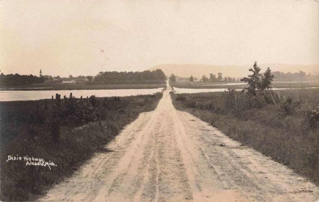
A period photograph labeled “Dixie Highway, Arcadia, Mich.” shows another side of early automobile travel.
The road appears as a pale dirt track running straight across open country. It crosses low ground and water before continuing toward the distant community. There are no painted lanes, paved shoulders or safety barriers. The image shows why early highway travel could be difficult even when a route appeared on a national map.
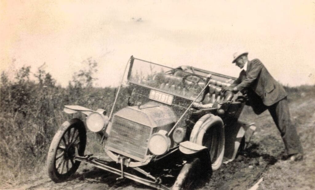
A named highway was not always a finished highway. Drivers commonly faced ruts, loose sand, and standing water. Flat tires were so frequent that motorists often carried several repair tools. Mechanical breakdowns could leave a family stranded miles from professional help.
Yet the road also represented freedom. It allowed ordinary people to reach parts of Michigan that had previously required a train ticket, a boat trip, or a long ride by horse.
Mackinaw City Becomes a Dixie Highway Landmark
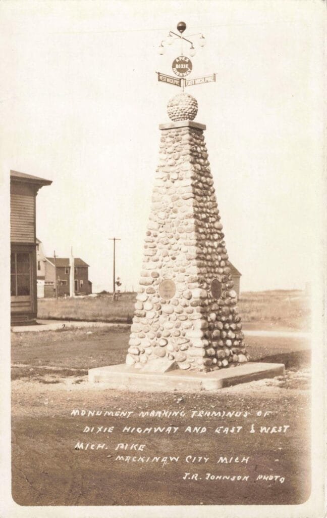
Mackinaw City became one of the most recognized Michigan points on the Dixie Highway.
A stone monument was erected near Central Avenue to mark the meeting place of the eastern and western divisions.
Historic postcards show a tall stone structure topped by a rounded stone sphere, lamps and directional signs. The monument stood in or near the street, surrounded by shops and early commercial buildings.
One postcard described the scene as the Dixie Highway from the monument and Central Avenue. Another identified the structure as marking the eastern and western termini.
For travelers, the monument carried practical and symbolic value.
It marked the top of Michigan’s Lower Peninsula. It also showed that the nation’s growing highway system had reached the Straits of Mackinac.
A motorist standing there could look south and imagine a connected route running through Detroit, Ohio, Tennessee, and Georgia before reaching Florida.
The Highway Creates a New Roadside Economy
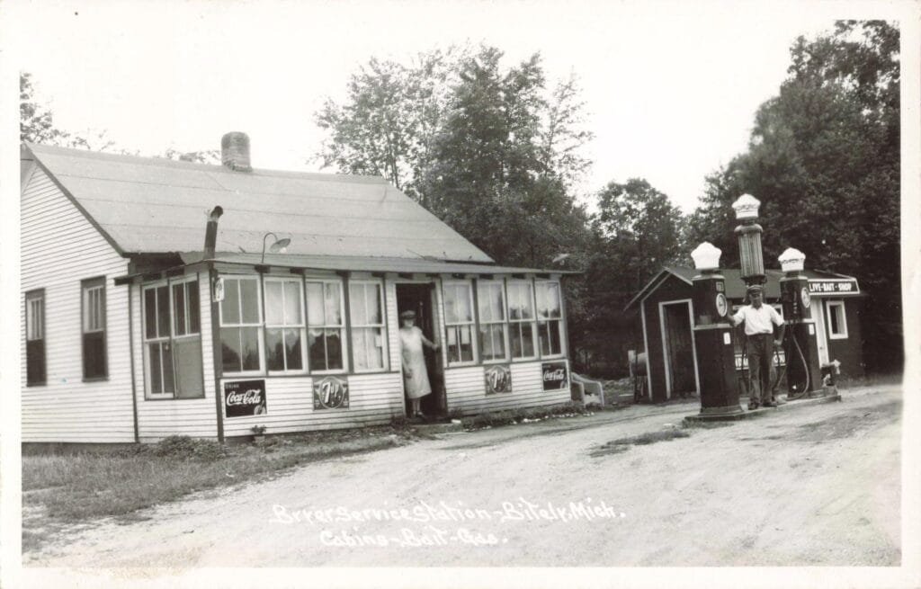
The Dixie Highway helped create a new roadside economy. Before automobile travel became common, many businesses clustered near railroad depots, ports, and established downtown streets. The highway shifted some of that activity toward the road.
Garages sold tires and performed repairs. Filling stations replaced improvised gasoline sales. Restaurants advertised meals to passing drivers. Hotels promoted parking and easy road access. Some farmers sold fruit, vegetables, and other goods directly to motorists. Resort operators placed signs farther from town to attract drivers before they passed the entrance.
The highway also helped communities market themselves to outsiders. A town was no longer simply a local center. It could be a stop on a road linking Michigan with the South.
The U.S. Highway System Replaces Named Roads
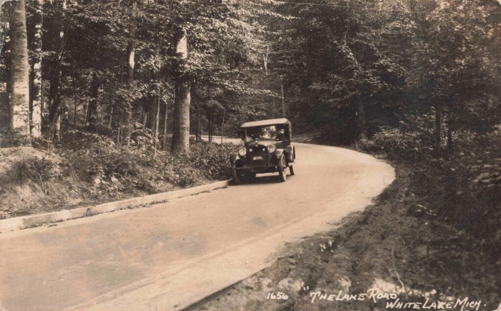
The Dixie Highway was part of the named-trail era of American road development. Those names helped motorists follow long-distance routes before a national numbering system existed. They also served as advertising campaigns. By the mid-1920s, however, the system had become confusing. Roads carried competing names, colors, symbols, and directional markers.
The federal government introduced the U.S. numbered highway system in 1926. Much of western Michigan’s old Dixie Highway route became U.S. 31. Parts of the eastern corridor were incorporated into U.S. 25 and other state and federal routes. The Dixie Highway Association lost its original purpose and dissolved during the late 1920s.
The familiar name began disappearing from official maps.
What Remains of the Dixie Highway in Michigan
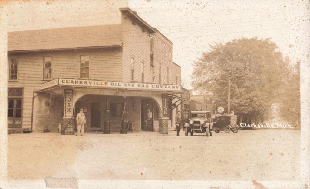
The Dixie Highway did not vanish completely. The name still appears on roads in southeastern Michigan, including portions of the old route through Oakland County. Other sections survive within U.S. 31, M-25, and local streets that follow earlier alignments.
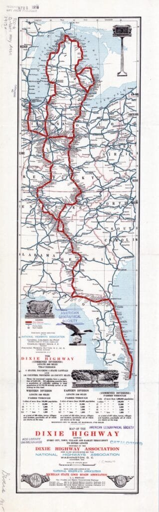
The original routes have been widened, straightened, and rebuilt. Some sections were bypassed. Others became busy commercial corridors that bear little resemblance to the dirt roads shown in early photographs.
Yet the historic images still tell the story. There is a quiet business district in Waterford. There is a rough road near Arcadia. There is a stone monument in Mackinaw City. There are the maps showing a dark line stretching from northern Michigan to Miami.
Together, they mark the period when Michigan began rebuilding itself around the automobile. The Dixie Highway was not one perfect road. It was often rough, poorly marked, and difficult to follow. But it gave Michigan communities a place in the nation’s first major north-south highway network. It brought tourists into small towns and pushed local governments to improve their roads.
Most importantly, it changed what Michigan drivers believed was possible. For the first time, a family could point an automobile south from Mackinaw City and imagine driving all the way to Florida.