 by
by How to read NOAA aurora maps, understand Kp values, and compare cloud forecasts before choosing a Michigan viewing spot.
A Michigan northern lights forecast starts with activity above Earth, but the decision to head outside often comes down to clouds. An encouraging aurora outlook offers little help when an overcast sky blocks the view. The useful forecast combines expected geomagnetic activity with local weather during the same hours.
That matters in a state stretching from the Keweenaw Peninsula to the Indiana and Ohio borders. A forecast mentioning Michigan cannot describe conditions at every shoreline, farm field, or city park. Readers need to narrow the outlook to a place and time before making plans.
For 2026 and 2027, the most useful approach is to pair NOAA Space Weather Prediction Center products with National Weather Service hourly forecasts. The steps below explain how to make that comparison. They provide a repeatable viewing routine, with official links to check conditions for the night you choose.
How to check the Michigan northern lights forecast tonight

Start with NOAA’s Aurora Dashboard, which brings together its nightly outlook and short-term aurora information. Check the dates on the products before interpreting them. A screenshot shared yesterday may describe a different night, even if its caption says “tonight.”
Next, check the hourly weather forecast for your intended viewing location. Compare cloud coverage with the period of expected aurora activity. Return to NOAA’s short-term product before leaving, especially if the outing requires a long drive.
Treat each check as a separate part of the decision. Space weather guidance addresses the aurora’s expected activity and location. The local forecast addresses whether the sky may allow a view. Neither product alone establishes that you will see a display.
Read NOAA’s current aurora maps

NOAA’s experimental Aurora for Tonight and Tomorrow Night maps show predicted aurora location and intensity over North America. They use the maximum forecast Kp between 6 p.m. and 6 a.m. Central time. That nightly maximum should not be read as an all-night promise.
Older instructions may tell readers to locate a southern “viewline” across the map. NOAA says it removed that line from this experimental product in May 2026. Its web address still contains the old term, which can make older tutorials confusing.
Read the current map’s legend and timestamp. The colored oval depicts modeled aurora, with colors changing as expected intensity increases. Being outside the oval does not automatically rule out seeing light toward the horizon. NOAA notes that bright aurora can sometimes be visible from a considerable distance under suitable conditions.
Choose the right forecast for the decision
NOAA offers several products because planning tomorrow’s outing differs from checking the sky before bed. Start with the broader outlook, then move toward products covering shorter periods. This keeps an old activity report from becoming the basis for a future plan.
| NOAA product | What it helps you do | What to remember |
|---|---|---|
| Tonight and tomorrow night maps | Compare the two nights | The maps use each night’s maximum forecast Kp |
| 3-Day Forecast | Plan ahead and read the forecaster’s explanation | Read the geomagnetic section and its valid times |
| Aurora — 30 Minute Forecast | Check near-term conditions | Its usual forecast lead is about 30 to 90 minutes |
| Planetary K-index | Follow estimated magnetic disturbance | Estimated activity and forecast activity are different |
The 3-Day Forecast combines recent observations with expected conditions and brief explanations. NOAA issues this product twice daily. Read the geomagnetic forecast when assessing aurora potential, rather than assuming every space weather alert means the same thing for Michigan viewers.
The Aurora — 30 Minute Forecast usually uses upstream solar wind measurements to estimate near-term aurora activity. NOAA describes a typical lead time of 30 to 90 minutes. When those measurements are unavailable or contaminated, the model can use Kp instead, with no forecast lead time.
That makes the short-term map useful before departure and during a viewing session. It cannot establish whether next weekend’s trip will produce a sighting. Always check the product time along with the picture.
What Kp values mean for Michigan
Kp describes disturbances in Earth’s magnetic field on a scale from zero to nine. NOAA’s estimated planetary index represents three-hour activity intervals, although its chart updates more frequently. It is a broad measure of geomagnetic conditions, not a percentage chance of seeing aurora from your location.
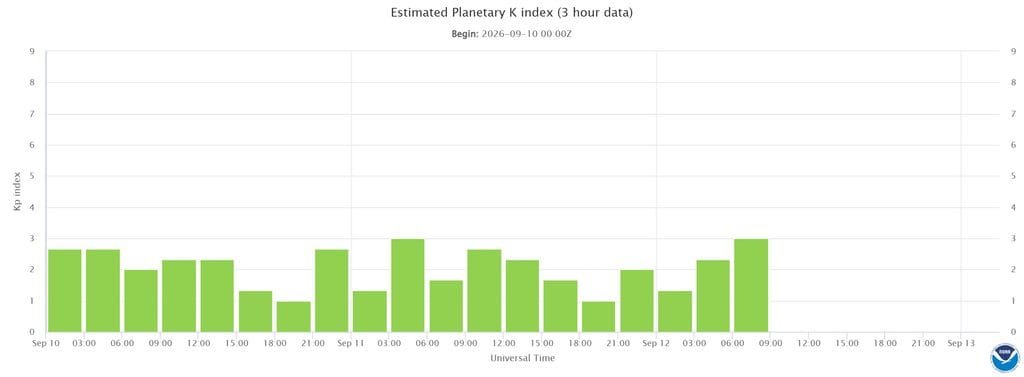
NOAA connects Kp to its geomagnetic storm scale as follows. The letters and numbers describe storm strength. They do not account for local clouds or artificial lighting. NOAA Planetary K-index
| Kp value | NOAA storm category |
|---|---|
| Below 5 | Below the G1 geomagnetic storm threshold |
| 5 | G1, minor |
| 6 | G2, moderate |
| 7 | G3, strong |
| 8 and 9-minus | G4, severe |
| 9o | G5, extreme |
The “o” in 9o distinguishes that value from nine-minus. For most readers, the useful task is to compare forecast strength with expected timing. Check whether the number refers to an upcoming period or to an activity already measured.
Avoid treating a particular Kp as a guaranteed Michigan sighting threshold. NOAA cautions that the relationship between activity and auroral latitude is approximate. Stronger activity generally expands opportunities farther south, but a single number cannot settle a local viewing decision. NOAA viewing guidance
Check sky cover rather than the chance of rain
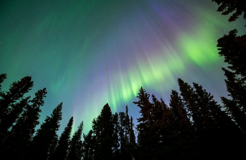
Open Weather.gov, enter your destination and select its hourly forecast. Look for sky cover during the hours you expect to watch. The hourly graph also provides temperature, wind, and other weather information useful for planning an evening outdoors. NWS hourly forecast instructions
Sky cover describes how much of the sky opaque clouds are expected to cover. A low chance of rain answers a different question. The NWS defines precipitation probability as the chance of measurable precipitation at a particular location during a specified period. A dry forecast can still describe a cloudy night. NWS forecast terms, NWS precipitation explanation
Compare several hours rather than relying on the daily weather icon. A forecast showing clouds early and clearing later may suggest a different departure time. Also compare the destination with a nearby alternative, using the same hours for both places.
Consider a hypothetical choice between an overcast U.P. location and a clearer northern Lower Peninsula location. If aurora activity extends far enough south, the clearer location could be the more practical option. This illustrates why driving north should be preceded by a weather check.
Which Michigan regions deserve a closer look
Michigan’s northern areas provide a useful starting point when reviewing an aurora outlook. NOAA’s general guidance favors locations near the magnetic pole, away from city lights, with an open view to the north. Local cloud conditions can change which location makes the most sense on a particular night. NOAA viewing guidance
The following comparison applies that guidance to Michigan geography. It is a planning framework, not an official NOAA regional forecast or a ranking for tonight.
| Michigan region | How to use it in your planning |
|---|---|
| Keweenaw Peninsula and northern U.P. | Begin the regional comparison here, then check local clouds |
| Other U.P. locations | Compare alternatives across the peninsula during the same viewing window |
| Northern Lower Peninsula | Assess locations around the Straits and farther south against the current aurora map |
| Thumb and Saginaw Bay | Check whether expected activity supports looking from this farther-south region |
| Central and southern Michigan | Look for a more extensive auroral event before considering a dedicated outing |
For someone in Caseville or Port Austin, the first decision is whether conditions warrant a local check. Someone in Detroit faces a different question if considering several hours of travel. Compare the destination’s forecast with conditions closer to home before committing to the drive.
Within any region, assess the actual viewing spot. Check the direction of the shoreline or open field and identify buildings or trees that could block your view. Confirm public access and parking arrangements before arriving after dark.
Match the forecast to Michigan’s clock
MICHIGAN4YOU · AURORA PLANNING
Match the forecast to your clock
Convert local time to UTC, or turn a NOAA forecast time into local time.
The date matters. Daylight saving time is applied automatically. UTC is also called Z time and uses a 24-hour clock.
Space weather products often use Coordinated Universal Time (UTC, or Z). Convert that time before deciding when to watch. For Eastern Daylight Time, subtract 4 hours from UTC. For Eastern Standard Time, subtract 5 hours. National Hurricane Center time explanation
For example, 03:00 UTC on Saturday corresponds to 11 p.m. on Friday during Eastern Daylight Time. The calendar date changes during the conversion. Use the time zone at your viewing location, including Central time where applicable, and check whether daylight saving time is in effect.
What to expect during 2026 and 2027
NOAA’s Solar Cycle Progression tracks observed and predicted sunspot activity and radio flux. Its projections provide context about the broader cycle and include uncertainty ranges. NOAA updates its fitted prediction as additional monthly observations become available.
Those charts cannot name the nights when clouds will clear over Michigan or aurora will become visible from a specific town. Use them to understand the broader setting for 2026 and 2027. Use operational forecasts to decide what to do on a particular evening.
Seasonal timing can help with general planning. NOAA identifies the spring and fall equinox periods as favorable for geomagnetic activity and roughly 10 p.m. to 2 a.m. local time as a useful viewing window. Displays can occur outside those hours, especially during stronger activity. Darkness and moonlight also affect visibility. NOAA viewing guidance
A final check before heading outside
Make the Michigan northern lights forecast part of a short routine. Keep the official forecast pages bookmarked and compare information carrying valid times for the same night. Before leaving, work through these five steps:
- Open NOAA’s nightly aurora map and confirm its date.
- Read the geomagnetic forecast and convert its timing to local time.
- Compare hourly sky cover at your destination and a nearby alternative.
- Choose an accessible spot with an open northern view and limited artificial light.
- Recheck the short-term aurora map before departure.
Keep plans flexible as the evening develops. An outlook can justify a closer look without promising a display. The most useful decision comes from matching the latest aurora information with the sky you can actually see.