 by
by An Early Map of Michigan Shorty After Statehood
The 1841 Michigan Map by H. S. Tanner is a unique print. Printed a few years after Michigan became a state this map shows many counties that no longer exist or have changed.
Many of the county names didn’t survive; on March 8, 1843, the legislature revised 16 of those counties’ names. This map is unusual because it captures this limited period.
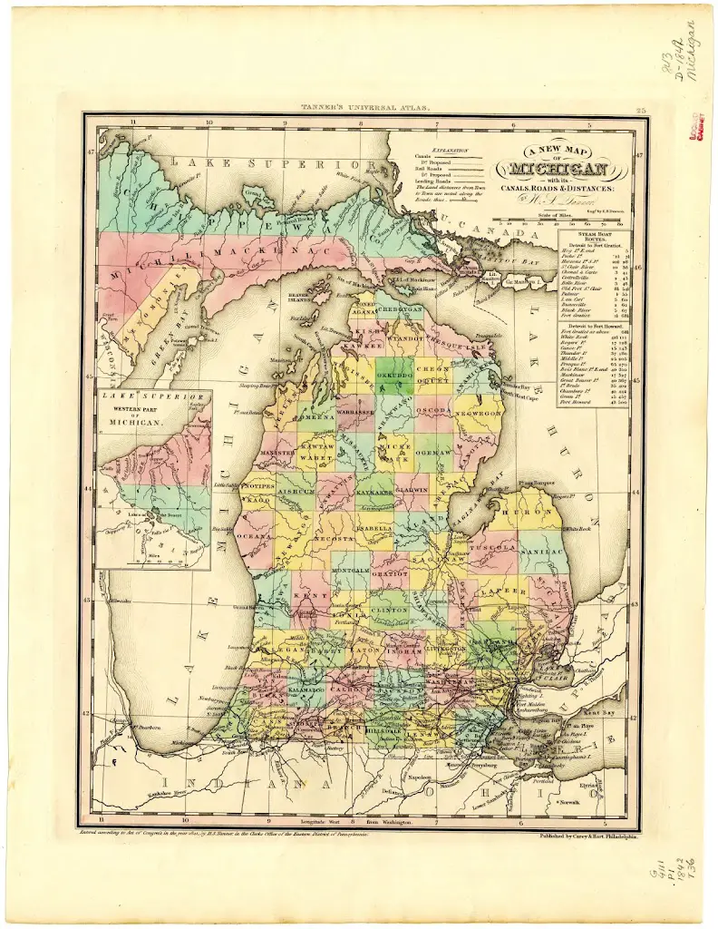
This rare map has an inset showing the western part of the Upper Peninsula and a travel table for Detroit Steam Boat Routes.
1841 Michigan Map Shows State Still A Wild Wilderness
This early map of Michigan, (Michigan was made a state in 1837), shows little expansion north of the lower two rows of counties with only several recognized cities or towns: Benton, Coltrellville, Corunna, Flint, Grand Haven, Grand Rapids, Hastings, Howell, Mason Centre (not yet Lansing), McDougalville, Mt. Clemons, Niles, Palmer, Pontiac, Portland, Remco, Saginaw, Saugatuck, Tomia Center, Utica, and Vermontville. At the tip of the Thumb, Huron county had no towns or cities marked or listed.

Thank you for writing this. It was very interesting! I found it while searching for info on Indian Trails in Michigan. I’ve bookmarked this site to come back to read more interesting things here.