 by
by Michigan weather can change within a few miles. A highway may be clear near home but covered with snow farther north. Summer road construction can also turn an easy drive into a long series of lane closures and detours.
MDOT live cameras give travelers a recent look at traffic, pavement, and visibility along many Michigan highways. The cameras are part of Mi Drive, the Michigan Department of Transportation’s official traffic and construction website.
Mi Drive also reports crashes, traffic speeds, construction zones, road closures, and active MDOT snowplows. Learning to use these basic tools can reduce surprises and help you decide whether to leave, wait, or take another route.
Table of Contents
Check Michigan Roads Now

I-75 @ M-61 – Refresh Browser to Update Image
Use these official links before leaving home:
- Open the MDOT Mi Drive map
- View the MDOT camera list
- Check National Weather Service forecasts
- Check Mackinac Bridge conditions
Check the map while parked or before leaving. A passenger can check it during the trip. Drivers should never operate the map while moving.
What MDOT Live Cameras Can Show You

A traffic camera provides something a written forecast cannot: a view of the road at a specific location.
During winter, the image may show whether snow is covering the pavement, traffic is moving slowly, or blowing snow is reducing visibility. During heavy rain, it may show standing water, vehicle spray, or backups caused by a crash.
In summer, the camera can help confirm whether construction has slowed traffic. It may also show congestion near a major interchange, tourist destination, or community event.
However, a camera shows only one location and one moment. Conditions may be worse several miles away. Darkness, glare, fog, and moisture on the camera lens can also make an image difficult to read.
A clear camera view does not guarantee that an entire route is safe.
How to Find a Camera on the Mi Drive Map
The map may look complicated at first, but most travelers need only a few controls.
Step 1: Open the Map
Go to the Mi Drive map. Allow a few seconds for it to load.
The map may ask whether it can use your location. You can permit this or type a city or ZIP code into the search box.
Step 2: Search for Your Destination
Enter the name of a city, ZIP code, or community near your route. You can also move the map with your mouse or finger.
Zoom in by using the plus button, your mouse wheel, or two fingers on a phone or tablet.
Step 3: Turn On the Camera Layer
Open the map’s layer or menu control. Select “Cameras.”
Small camera symbols should appear where MDOT camera views are available. Select one of those symbols to open the camera window.
If the camera is unavailable, try another camera nearby. MDOT says camera images can be interrupted by power failures, equipment problems or communications outages.
Step 4: Check the Direction and Time
Read the camera’s location carefully. A camera on I-75 may face north, south or across an interchange.
If the window includes a time or update notice, make sure the view is recent. A bright summer image during a nighttime search may indicate that the feed has stopped updating.
Step 5: Check More Than One Camera
Never base a travel decision on one camera.
Check several points along the route. During a winter storm, compare cameras near your starting point, midway through the trip and near your destination. This can show where conditions begin to change.
Step 6: Add Traffic and Closure Information
Turn on the layers for incidents, traffic speeds, lane closures and total closures. These reports may explain why traffic appears stopped in a camera view.
Mi Drive allows users to save favorite cameras. This can be useful for routes driven often, such as trips to a cottage, airport, medical appointment or family home.
Understanding the Mi Drive Map Layers
| Map layer | What it tells you |
|---|---|
| Cameras | Recent highway views showing traffic, pavement and visibility |
| Incidents | Crashes and other events affecting traffic |
| Current speeds | Green usually means normal traffic; yellow, orange and red indicate increasing delays |
| Lane closures | A lane is closed, but some traffic may still pass |
| Total closures | The highway or ramp is closed at that point |
| Future closures | Planned work that may affect an upcoming trip |
| Maintenance vehicles | Locations of active MDOT snowplows or maintenance trucks |
| Message signs | Current wording displayed on electronic highway signs |
| Truck parking | Available information about designated truck parking areas |
MDOT’s lane-closure information covers Michigan’s I, M, and US routes. It does not provide a complete report for every county road, city street, or private road.
Why Cameras Matter During Michigan Weather Events

Michigan weather is often highly local. Lake-effect snow may reduce visibility on one section of highway while roads remain clear 10 miles away. Freezing rain can also make a road slick before snow begins to accumulate.
Camera views can help answer several basic questions:
- Is snow sticking to the pavement?
- Are vehicles moving at normal speed?
- Is spray or blowing snow reducing visibility?
- Are plows working along the route?
- Has a crash stopped traffic?
- Does the next section of the trip appear worse?
Use the cameras with a current National Weather Service forecast and official warnings. A camera cannot reliably show black ice, pavement temperature or every hazard.
Michigan State Police advises drivers to slow down on snowy or icy roads. Stopping can take much longer under those conditions. Travelers should also allow additional time and tell someone their route and expected arrival time. Michigan State Police provides more winter travel guidance.
How to Find MDOT Snowplow Cameras
During winter, turn on the “Maintenance Vehicles” layer.
Select a snowplow symbol to see available information about the truck. Some listings include a view from the vehicle that shows current conditions from the plow driver’s position.
The MDOT snowplow layer is generally available from late autumn through early spring. It tracks participating MDOT vehicles, not every county, city or private snowplow in Michigan. MDOT explains its snowplow tracking system here.
A nearby snowplow does not mean the road is clear. Heavy snowfall can cover pavement again within minutes.
Using Mi Drive During Summer Construction

Michigan’s highway construction season often overlaps with its busiest travel months. A route that worked well last summer may have lane closures, reduced speeds or a major detour this year.
Several days before a trip, turn on the “Future Closures” layer. Check the route again on the morning of departure using the current lane-closure and total-closure layers.
Select each construction marker for details. Look for:
- The affected highway and direction
- Start and expected completion dates
- Closed lanes or ramps
- Suggested detours
- Restrictions affecting trailers or large vehicles
Checking early gives you time to change the route, leave earlier or schedule a meal and fuel stop before reaching a major work zone.
Southeast Michigan: Watch Traffic on Busy Freeways
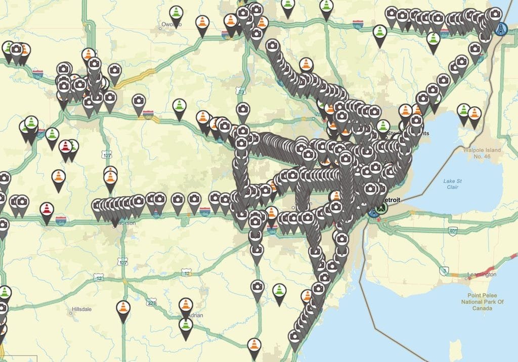
The live map opens on the official Michigan Department of Transportation website.
Southeast Michigan has the state’s largest concentration of interstate highways, major interchanges and daily traffic.
Travelers may find camera coverage along I-75, I-94, I-96, I-275, I-696, US-23, M-10 and M-39. These routes serve Detroit, Ann Arbor, Pontiac, Dearborn, Metro Airport and the surrounding suburbs.
Turn on the current-speed layer before traveling through the region. Green indicates traffic is moving near its normal pace. Yellow, orange and red indicate increasing delays.
Cameras are especially useful near large interchanges. A single crash or construction closure can slow several connecting freeways. Check both the main highway and the route you plan to use as a backup.
Southwest Michigan: Check for Lake-Effect Snow and I-94 Delays
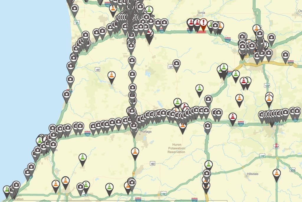
The live map opens on the official Michigan Department of Transportation website.
Southwest Michigan travelers commonly use I-94, I-196, US-31, and US-131. These routes connect New Buffalo, Benton Harbor, Kalamazoo, South Haven, Holland, and Grand Rapids.
Lake-effect snow can create sharp changes between the Lake Michigan shoreline and inland communities. One camera may show wet pavement while another shows snow-covered lanes and poor visibility.
Check several cameras from west to east rather than relying on the view closest to home. In summer, review construction reports before traveling to lakeshore towns, beaches, and festivals. Heavy weekend traffic can make a lane closure more disruptive than it appears on a map.
The Thumb: Cameras Help, but Local Reports Still Matter
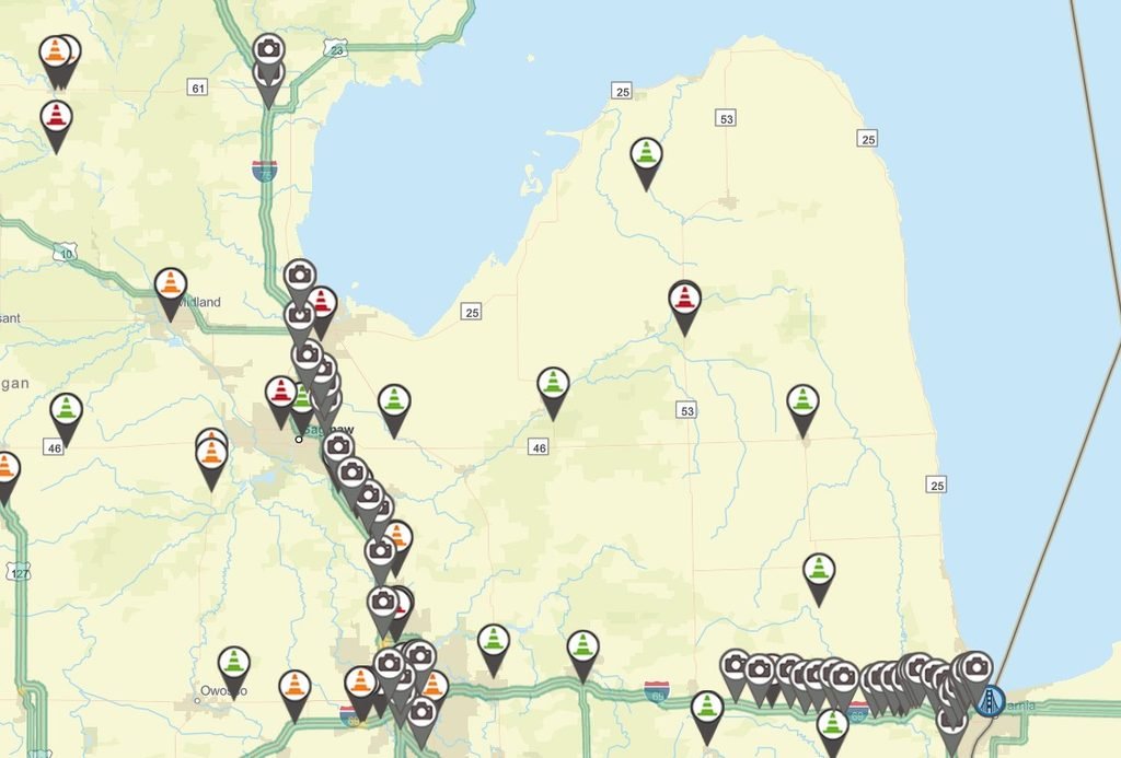
The live map opens on the official Michigan Department of Transportation website.
Travelers entering Michigan’s Thumb may use I-69 toward Port Huron before continuing on M-25, M-53, M-46, or other state routes.
Camera locations may be farther apart than they are in Metro Detroit. Even where a camera is unavailable, the Mi Drive incident and closure layers can still provide useful information about state highways.
This is important during heavy fog near Lake Huron and Saginaw Bay, winter snow squalls, and summer storms. Camera views near the edge of the region may provide an early warning of falling visibility.
Summer visitors should check for work on M-25 and other routes leading to Caseville, Port Austin, Harbor Beach and Port Sanilac. Construction and festival traffic can place additional pressure on roads with few practical detours.
Because Mi Drive does not provide complete coverage of county roads, also check notices from the Huron, Sanilac or Tuscola county road commission when severe weather or flooding affects the area.
Mid-Michigan: Check Routes Around Lansing, Flint and Saginaw
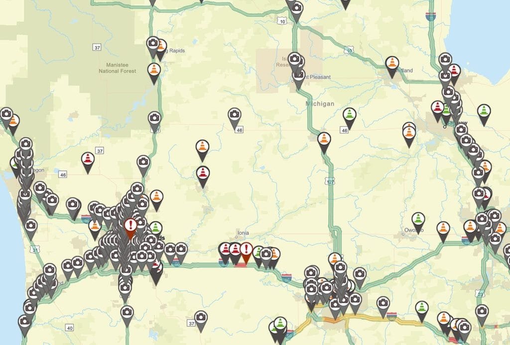
Major Mid-Michigan routes include I-69, I-96, I-496, US-127, US-10, I-475 and I-675.
The Mi Drive map can help travelers check traffic around Lansing, Flint, Saginaw, Bay City and Mount Pleasant. These routes often carry people crossing the state as well as drivers attending concerts, sporting events and festivals.
Construction near Lansing interchanges can affect more than one highway. Turn on both the current and future closure layers before a planned trip.
During winter, compare cameras north and south of your destination. Conditions near Lansing may not match those farther north near Clare, Mount Pleasant or Bay City.
Northern Lower Michigan: Check Long Routes and Bridge Conditions
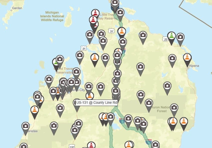
The live map opens on the official Michigan Department of Transportation website.
Travelers in the northern Lower Peninsula often depend on I-75, US-131, US-23, M-32, and M-72.
Distances between towns are longer, and alternate routes may add considerable time. Check cameras near Grayling, Gaylord, Alpena, Traverse City, and the approaches to Mackinaw City when available.
Winter travelers should pay close attention to visibility. Blowing snow can be as serious as snow on the pavement. During freezing rain or an ice storm, fallen trees and power outages may also affect roads and camera service.
Anyone heading across the Mackinac Bridge should check the Mackinac Bridge Authority’s current conditions page. Bridge officials may issue high-wind advisories, require escorts or restrict certain vehicles. Campers, trailers, and other high-profile vehicles require special care in strong winds.
Michigan’s Upper Peninsula: Use Cameras to Plan for Distance and Snow
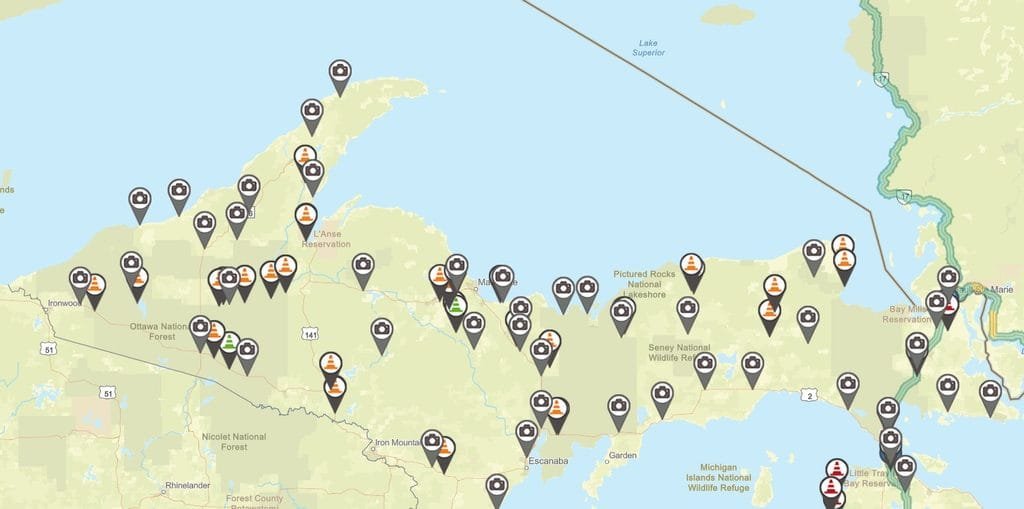
The live map opens on the official Michigan Department of Transportation website.
Upper Peninsula travel requires more advance planning. Important routes include I-75, US-2, US-41 and M-28.
Snowfall can be heavy, communities may be far apart, and alternate routes can add many miles. During major storms, blowing and drifting snow may reduce visibility or make a highway impassable.
Check cameras or snowplow views at several points along the route. A clear view near Marquette does not guarantee the same conditions near Munising, Newberry, Ironwood, or Sault Ste. Marie.
Look at the incident and closure layers before leaving. Also, check the National Weather Service forecast for the part of the Upper Peninsula you will be entering. Weather warnings may cover only part of the region.
Carry winter supplies, keep the fuel tank from getting too low, and tell someone when you expect to arrive.
Frequently Asked Questions About MDOT Live Cameras
Are MDOT traffic cameras really live?
MDOT describes the cameras as providing live viewing. They are not continuously recorded, and an image may stop updating because of an equipment, power or communications problem.
Does MDOT save camera recordings?
MDOT states that Mi Drive camera views are not continuously recorded. Travelers should not assume that historical footage will be available after a crash or other event.
Why is a camera missing or unavailable?
A camera may be temporarily removed from the map because of maintenance, equipment trouble, a power failure or a communications outage. Check another camera nearby.
Does Mi Drive cover every Michigan road?
No. MDOT maintains Michigan’s I, M and US routes. Its lane-closure information does not cover every county road or local street.
Can a camera tell me whether a road is safe?
No. A camera provides only a limited view. It may not show black ice, strong crosswinds or hazards outside the camera frame. Use camera images with weather forecasts, official warnings and closure reports.
Should I check the map while driving?
No. Check it before leaving, while parked or through a passenger. Pull off the road safely before changing a route or opening another camera.
A Five-Minute Check Can Prevent a Long Delay
MDOT live cameras cannot predict every problem, but they can help Michigan travelers make better decisions.
Check the map before leaving. Review more than one camera. Turn on the traffic, incident, and construction layers. During severe weather, compare the camera views with National Weather Service warnings.
Five minutes spent checking road conditions may help you avoid a long construction delay, a closed highway, or a drive into worsening weather.
Works Cited
Mackinac Bridge Authority. “Current Bridge Conditions.” Mackinac Bridge Authority. Accessed 22 Aug. 2026.
Michigan Department of Transportation. “MDOT Snowplows.” State of Michigan. Accessed 22 Aug. 2026.
Michigan Department of Transportation. “Mi Drive.” State of Michigan. Accessed 22 Aug. 2026.
Michigan State Police. “Be Prepared.” State of Michigan. Accessed 22 Aug. 2026.
Michigan State Police. “Travel Information for Motorists.” State of Michigan. Accessed 22 Aug. 2026.
National Weather Service. “National Weather Service.” National Oceanic and Atmospheric Administration. Accessed 22 Aug. 2026.